Transboundary water management in the Mediterranean region
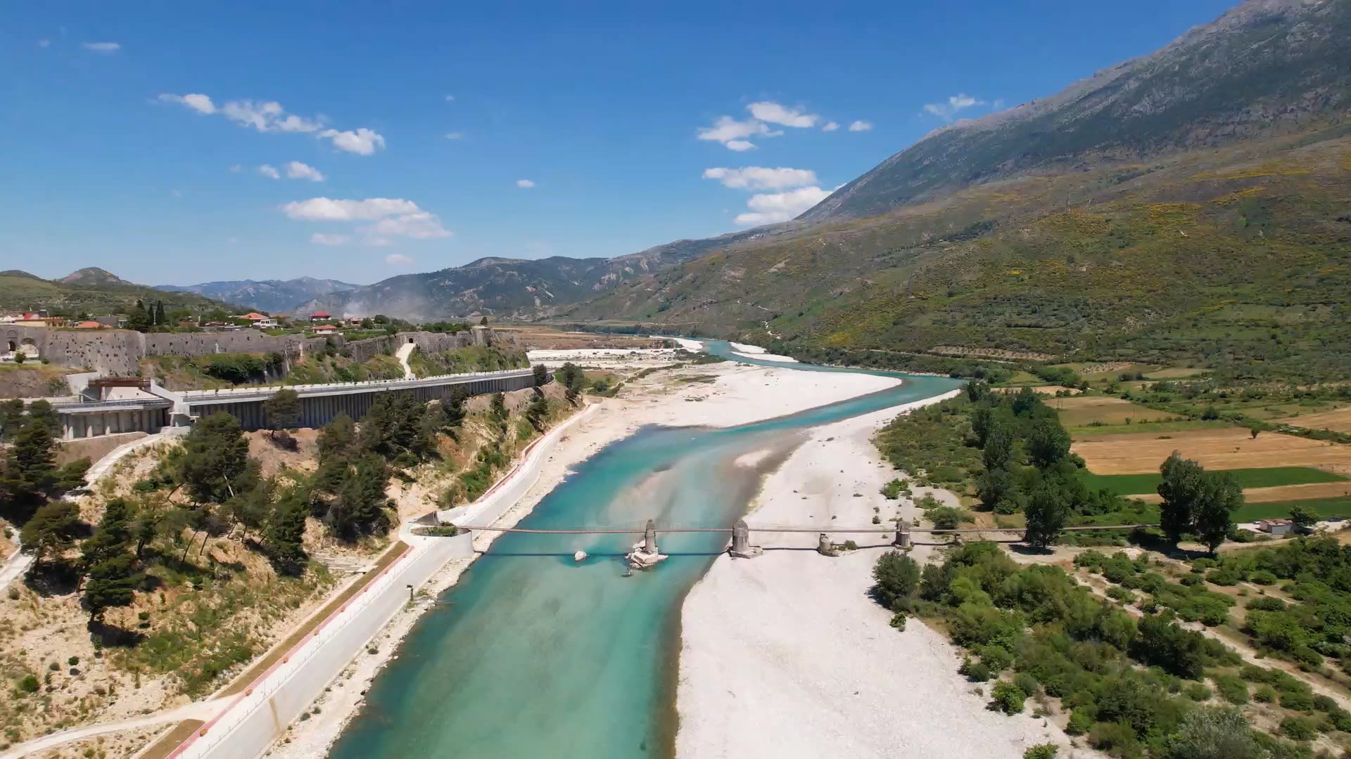
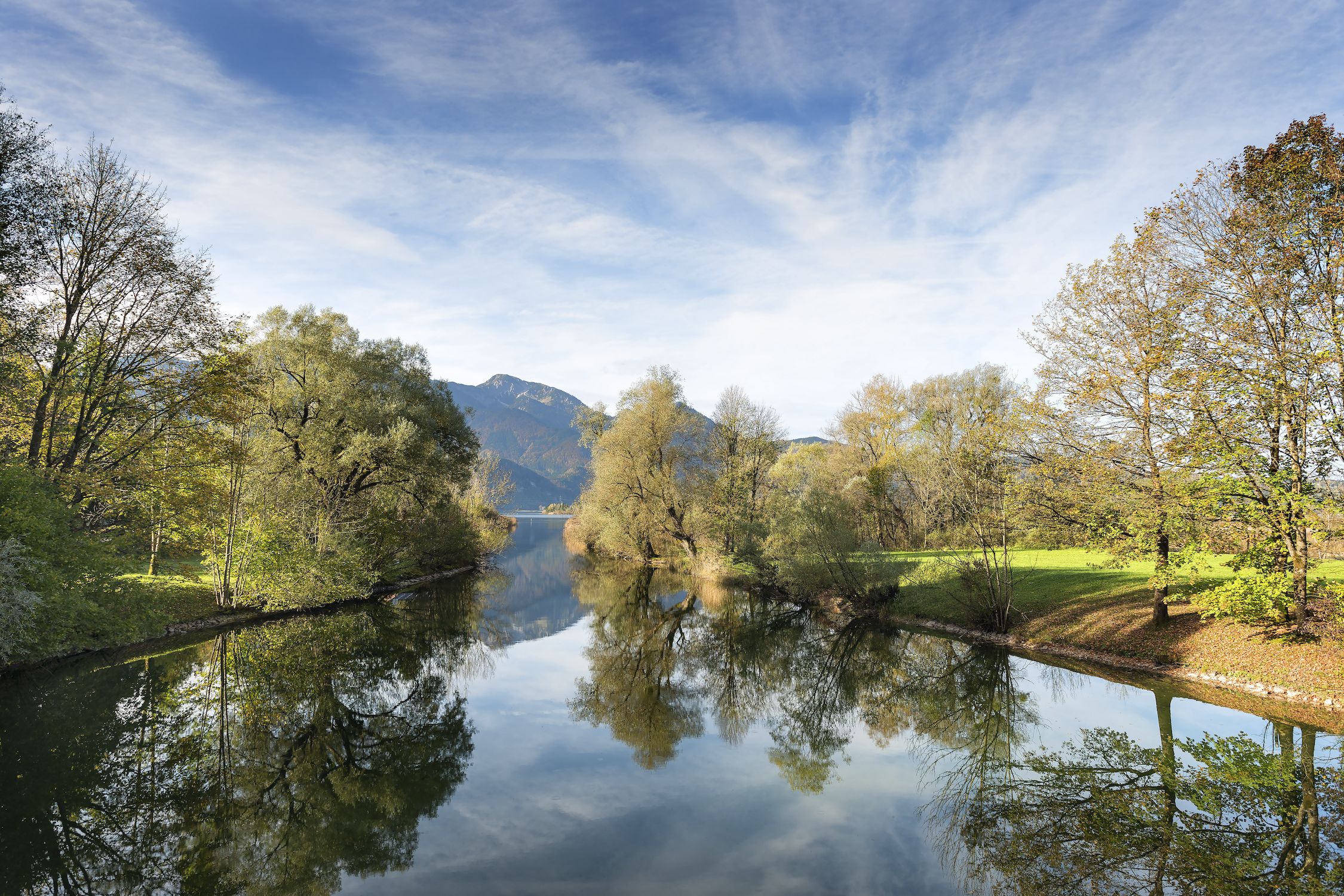
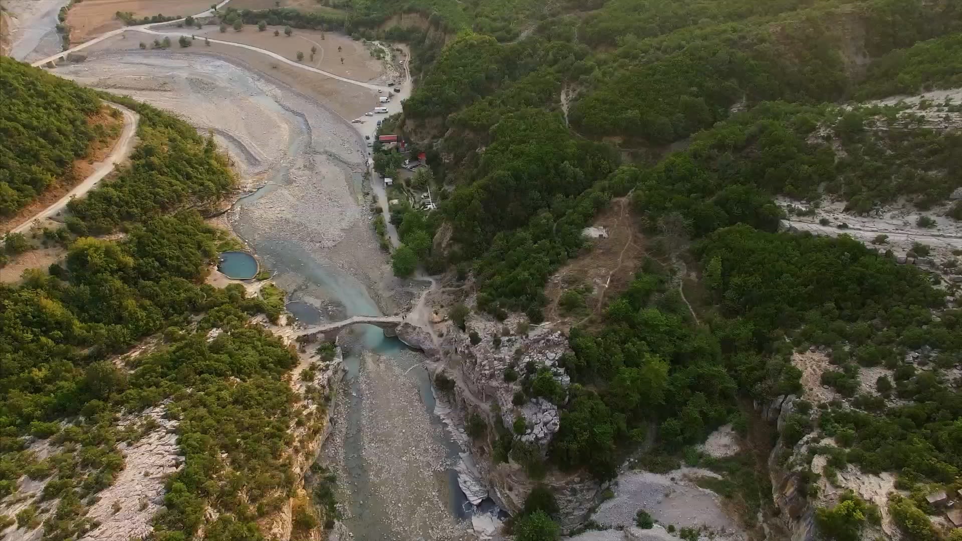
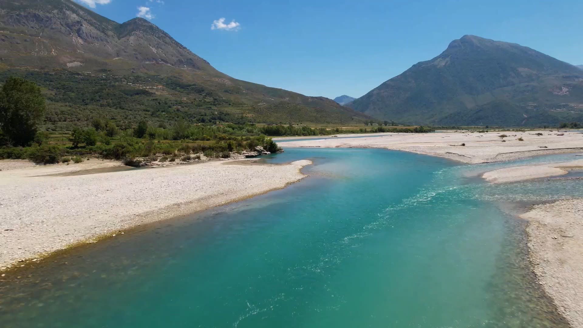
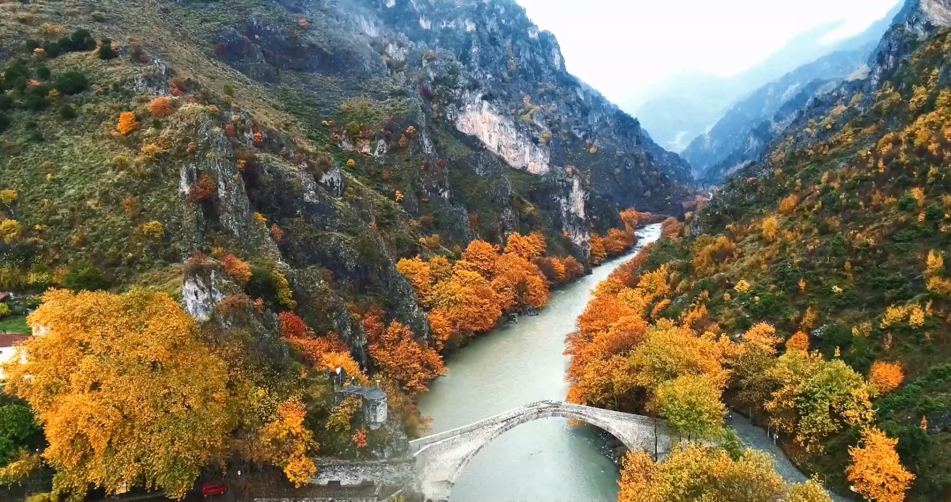
The Aoös, one of Europe’s last wild rivers, originates in the Pindus mountains of northern Greece. It flows northwest along the mountain chain into Albania where it takes the name Vjosa and continues to wind through to its mouth at the Adriatic Sea.
The 270 km river is of great ecological value, supporting a huge variety of flora and fauna, and providing water resources to populations living and working along its banks. But the Aoös/Vjosa faces growing challenges as the climate changes, and water management is becoming complex — not least because the river basin crosses national borders.

The Aoös river flows from Greece into Albania where it changes name to Vjosa. Credit: Google
The Aoös river flows from Greece into Albania where it changes name to Vjosa. Credit: Google


To help with the management and conservation of the river, Greek water resource management firm EMVIS needed to know how climate change could alter the quality and quantity of the water.
The team at EMVIS carried out a climate change assessment of the river based on data and tools developed by the Swedish Meteorological and Hydrological Institute (SMHI) on behalf of the Copernicus Climate Change Service (C3S).
Their findings show how C3S data and tools could benefit transboundary water management across Europe, something which will become increasingly important as the world’s climate changes.
A wealth of data in one place
“Climate impact assessments for the water-related sector is always about the data, the available data […] But after finding the C3S data service, you find a wealth of well documented data in one place.”
“Rivers do not follow political borders. A pan-European service is therefore of utmost importance to provide water managers and authorities with a common knowledge base for
making decisions for the benefit of activities in
trans-national river basins.”
Peter Berg, SMHI
When problems arise in rivers, they too are shared by neighbouring countries, making them challenging to manage.
The Mediterranean already suffers from significant water management issues, and the effects are being felt throughout the region. Climate change is expected to amplify this problem, as it will have a large impact on precipitation and the availability of water resources.
In transboundary basins such as the Aoös/Vjosa, it can become challenging to plan concerted actions such as regulating water activities, managing discharge, or establishing limits on water-related tourism. Actions in one country can have downstream effects into another, and transboundary cooperation is not always reliable.

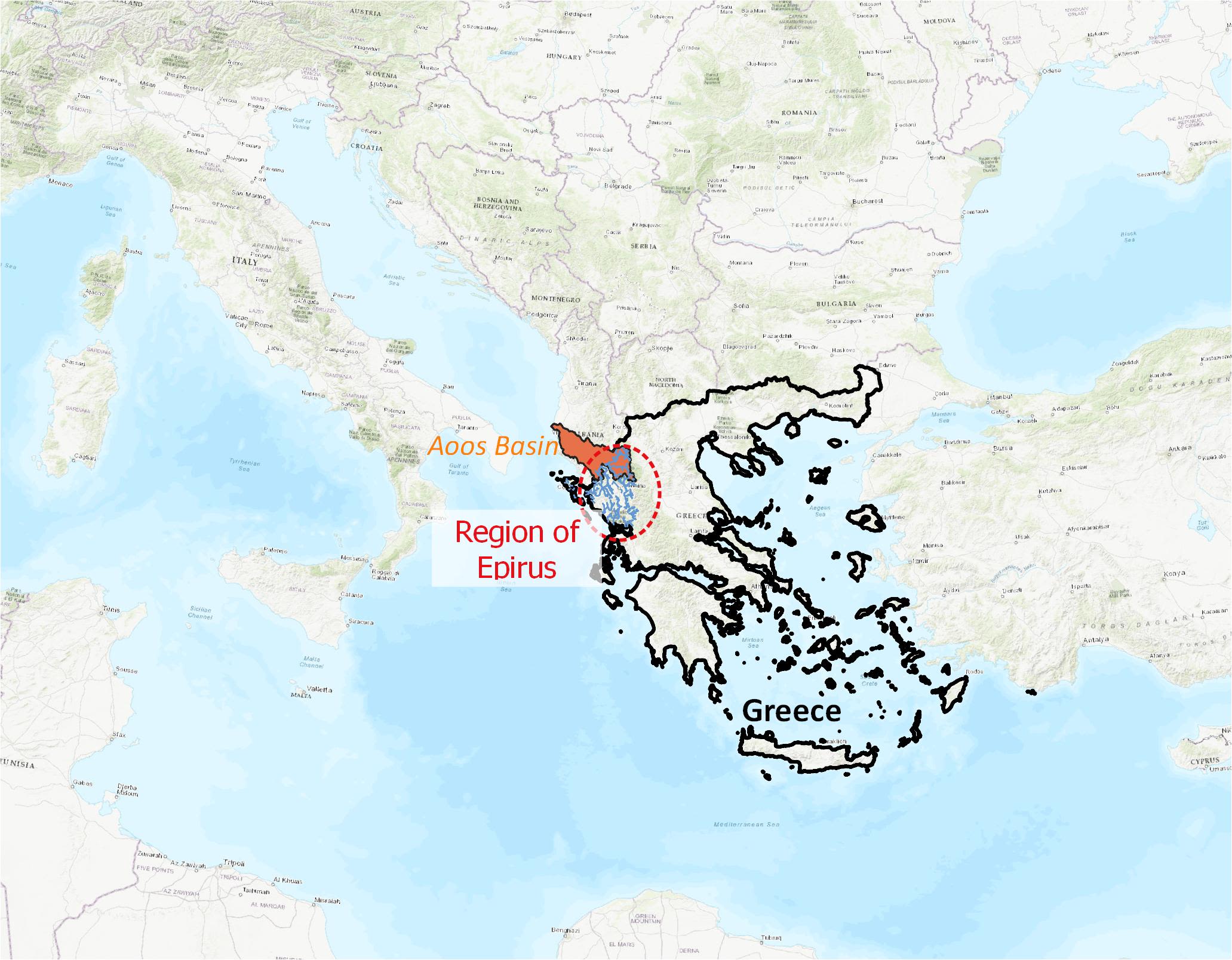
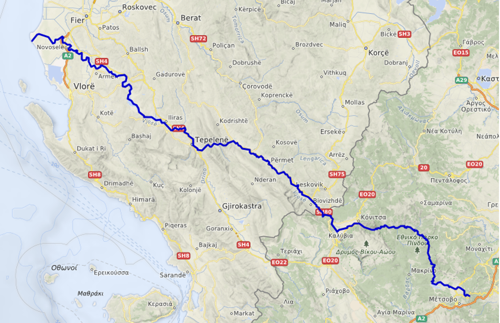
Project area is the region of Epirus in Greece covering the transboundary basin of the Aoös/Vjosa river.
Project area is the region of Epirus in Greece covering the transboundary basin of the Aoös/Vjosa river.
Authorities and water managers need detailed information on how bodies of water across Europe are changing, so that transnational river basins can be maintained and conserved for the future.
Climate change is predicted to have a significant impact on precipitation across continental Europe, though the impacts will vary from region to region, and between seasons.
As Earth’s surface warms, many areas of Europe will see increasing evaporation and more frequent intense precipitation events. The combined effects may reduce surface water flows and limit their distribution, inhibiting the replenishment of groundwater reserves and impacting the ecological status of surface waters.
Under the high-emissions scenario RCP 8.5, models project an increase in precipitation in northern Europe of as much as 30%. In southern Europe, where the Aoös/Vjosa is found, water scarcity is already a problem, and there could be up to a 40% reduction in precipitation by the end of the 21st century.
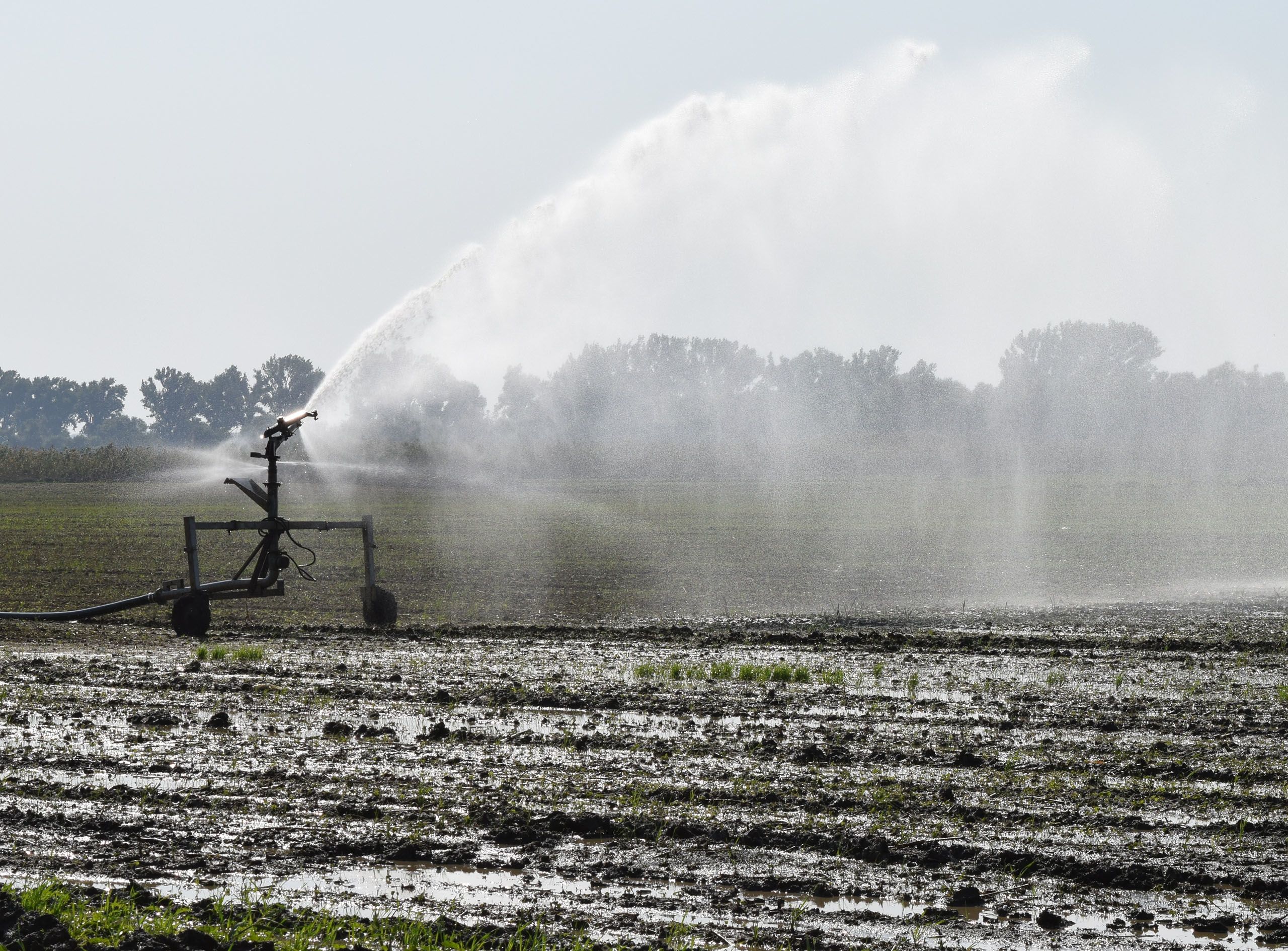
Changes in rainfall and temperature are also expected to increase water needs for irrigation. As demand for water rises while supply falls, water management strategies will be paramount.


Development of a database and data explorer
SMHI developed a dataset and data explorer – both available through the Climate Data Store (CDS) – on behalf of C3S to make it more accessible to a wider user group. The intended users are those in water management, and the agriculture and energy industries, who could benefit from detailed information on water availability.
The dataset, ‘Hydrology related climate impact indicators from 1970 to 2100 derived from bias adjusted European climate projections’, uses hydrological impact modelling to produce daily, monthly and annual average water data from 1970 to 2100.
Users can access data on discharge, aridity and a host of chemical variables related to water quality. These are provided as climate impact indicators (CIIs), which can help users understand the current climate, and signal expected changes under ‘degree’ scenarios, based on different levels of global warming.

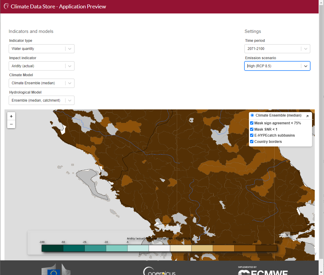
Expected changes in aridity around the Aoös/Vjosa River for the period 2071–2100, from the ‘European water and climate data explorer’. Credit: Copernicus Climate Change Service, ECMWF.
Expected changes in aridity around the Aoös/Vjosa River for the period 2071–2100, from the ‘European water and climate data explorer’. Credit: Copernicus Climate Change Service, ECMWF.

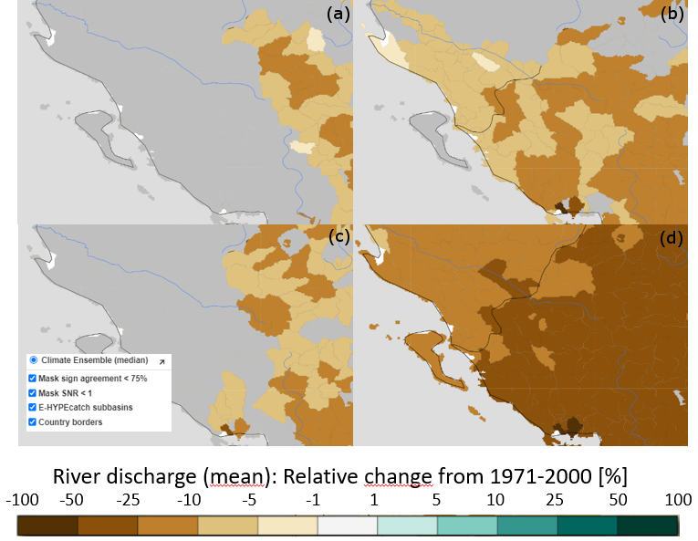
Expected changes in river discharge from the CDS application ‘European water and climate data explorer’, (a) 2011–2040, RCP 4.5, (b) 2071–2100, RCP 4.5, (c) 2011–2040, RCP 8.5, (d) 2071–2100, RCP 8.5, for the transboundary (Greece-Albania) basin of Aoös/Vjosa River, in view of possible bilateral cooperation for water management. Credit: Copernicus Climate Change Service, ECMWF.
Expected changes in river discharge from the CDS application ‘European water and climate data explorer’, (a) 2011–2040, RCP 4.5, (b) 2071–2100, RCP 4.5, (c) 2011–2040, RCP 8.5, (d) 2071–2100, RCP 8.5, for the transboundary (Greece-Albania) basin of Aoös/Vjosa River, in view of possible bilateral cooperation for water management. Credit: Copernicus Climate Change Service, ECMWF.
Exploring the data
The SMHI team then designed an application to visually explore the dataset housed in the CDS.
The ‘European water and climate data explorer’ lets users quickly and easily visualise CIIs based on combinations of climate and hydrological models.
The application produces detailed maps at local or pan-European scales, which is particularly useful to those in the water management sector — and especially to those working in transboundary areas.
“The application will increase trust in climate projection data because they are based on C3S credibility.
Transboundary cooperation will be further facilitated through interpretation of the projections from a common source.”
Using the data
to perform a climate assessment
Water research company EMVIS used the new data explorer to carry out an initial assessment of the main CIIs, to start building a picture of climate change impacts on the Aoös/Vjosa.
“Having easy access to a web-based service for pan-European climatic and water related data, well supported and covering a wide range of state-of-the-art data, has both encouraged and leveraged our services in climate change impact and adaptation assessments. It is an inspirational effort as well, in the web-services development sector. Looking forward to what is next.” Alexandros Ziogas, EMVIS

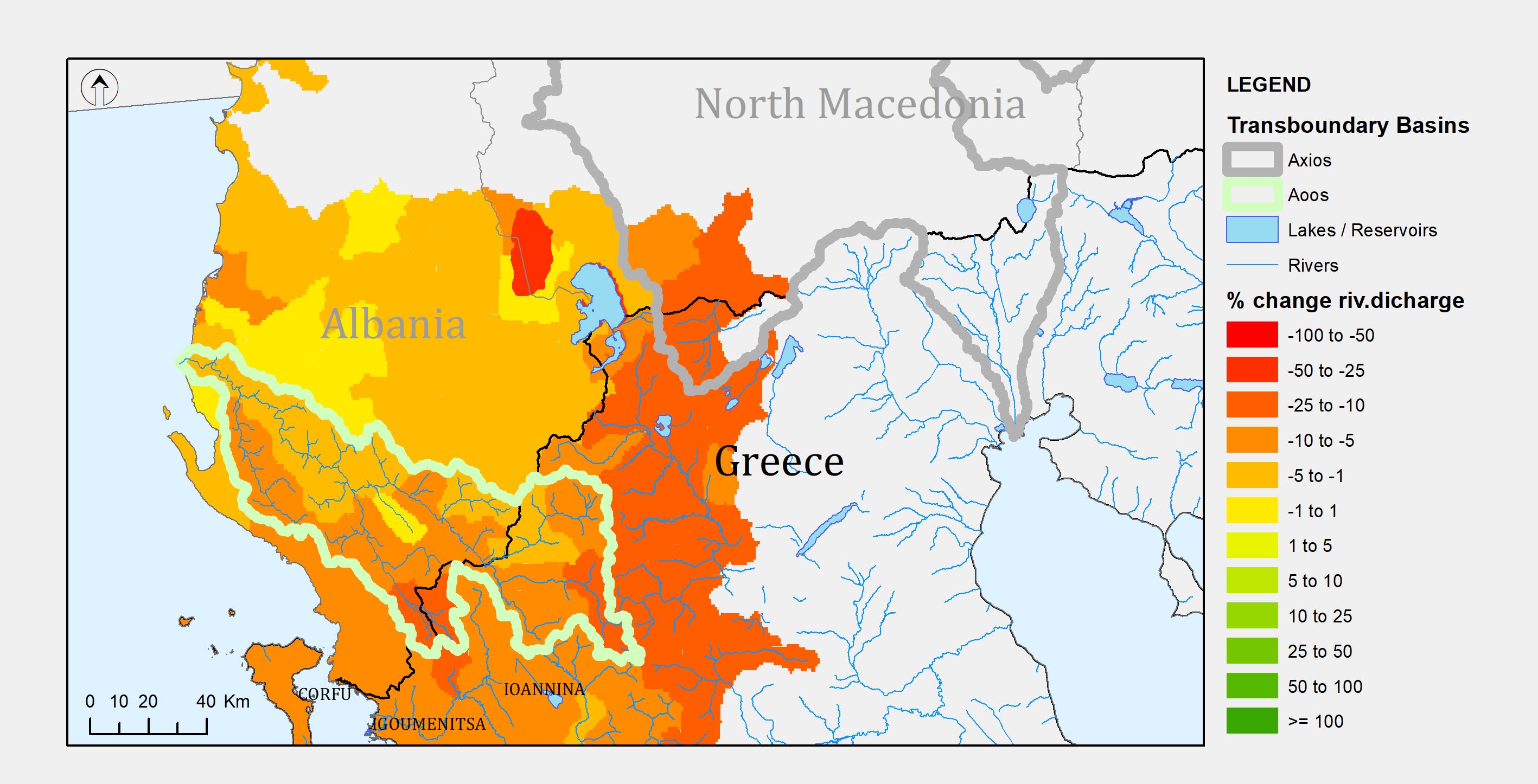
C3S data plotted in EMVIS’ own GIS environment. River discharge change for transboundary applications in the border of Greece - Albania - North Macedonia: annual change (%) for 2071–2100 in comparison to 1971–2000 (RCP 4.5, ensemble average). Credit: Copernicus Climate Change Service, ECMWF.
C3S data plotted in EMVIS’ own GIS environment. River discharge change for transboundary applications in the border of Greece - Albania - North Macedonia: annual change (%) for 2071–2100 in comparison to 1971–2000 (RCP 4.5, ensemble average). Credit: Copernicus Climate Change Service, ECMWF.
With a clear picture established, EMVIS then went back to the raw data to plug into their own visualisation software.
An external storage platform provides shapefiles– a geospatial vector format – making visualising of the data easy in a range of mapping software. EMVIS plotted the C3S data in their own geographic information system (GIS) software, to help assess the vulnerabilities of different regions around the river to the impacts of climate change.
By using the freely-available data from the C3S, EMVIS researchers used exposure and sensitivity assessments to easily map out the predicted impacts of different climate change scenarios in regions across Greece.
They focused on daily and monthly mean river discharge, and actual aridity under RCP 4.5 and RCP 8.5. This trial quickly provided clear evidence that there would be increasing drying across the Aoös/Vjosa river basin throughout the 21st century.

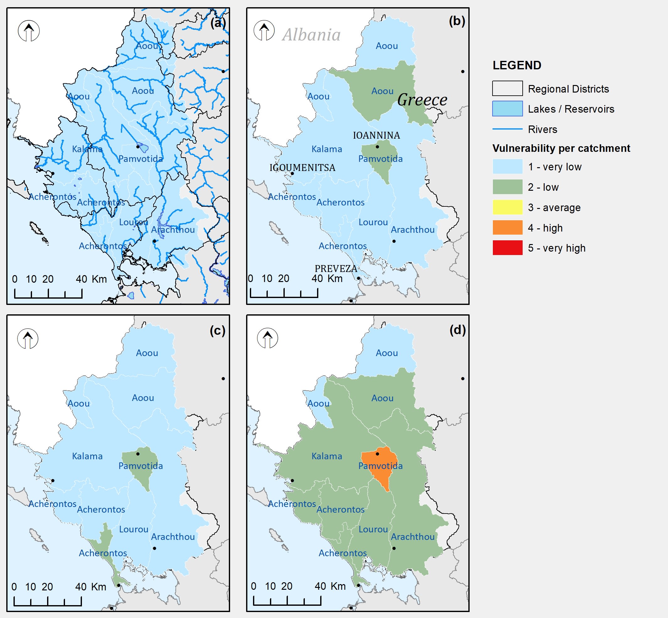
Surface water vulnerability for (a) 2011–2040, RCP 4.5, (b) 2071–2100, RCP 4.5, (c) 2011–2040, RCP 8.5, (d) 2071–2100, RCP 8.5. C3S data plotted in EMVIS’ own GIS environment. Credit: Copernicus Climate Change Service, ECMWF.
Surface water vulnerability for (a) 2011–2040, RCP 4.5, (b) 2071–2100, RCP 4.5, (c) 2011–2040, RCP 8.5, (d) 2071–2100, RCP 8.5. C3S data plotted in EMVIS’ own GIS environment. Credit: Copernicus Climate Change Service, ECMWF.
From data to solutions
“We are translating the C3S data into applicable solutions, into applicable management plans for the water sector.”
Aridity across the entire length of the Aoös/Vjosa is predicted to rise, with high confidence in the climate change signal.
At a river basin level, they found surface water resource vulnerability for the average year to be ‘very low’ in the medium term (2011–2041) for both RCP 4.5 and 8.5 emission scenarios. For the end of the century, (2071–2100), the general vulnerability is estimated to be ‘very low’ to ‘low’.
However, they could see that surface water in the Epirus region, where the Aoös/Vjosa runs, is particularly vulnerable to changes under the RCP 8.5 ‘business-as-usual’ scenario. This is mainly due to higher levels of water extraction here.
This information is critical to regional administration units, who are working on the development and implementation of local adaptation plans for climate change, and can focus on reducing the expected impacts.


Government ministries can also use the EMVIS climate change assessment to support new water and environmental policies, and the creation of nationwide water management plans.
These kinds of climate data are particularly useful in transboundary basins, such as the Epirus region. Finding compatible, accurate and up-to-date climate data across border regions can be challenging. With a common approach from both sides, transboundary management could be improved dramatically.

A boost for Europe’s water resources
The dataset, data explorer application, and trial of the data helped improve future outlook for clean water and sanitation. In this way they all contribute toward the United Nations’ Sustainable Development Goal SDG 6: Clean water and sanitation.
The investigation in the Epirus region of Greece specifically addresses certain targets: 6.4 (efficient water-use across all sectors); 6.5 (integrated water resource management); and 6.6 (protect and restore water-related ecosystems).
Overall, the projects from SMHI and EMVIS will foster more sustainable water resource management throughout the entire river basin.
Helping transboundary water management across Europe
The approach used by EMVIS researchers can be easily replicated and tailored to other regions across Europe. Water managers working in transboundary areas and policymakers on either side of a border can draw on the reliability of the shared information to create combined management plans. With the quality-assured data, everyone involved can be assured that decisions are being based on fact, and actual predictions about the future of managed water resources.
Beyond water management, the approach could benefit other industries that require information about water quantity and quality. Policymakers may need to know about the effects of industries releasing effluent discharge into water sources. Investments in the tourism industry, particularly regarding long term water-dependent infrastructure, like pools and golf courses, would benefit from knowing how water levels may evolve over time.
The open-source data available through the CDS is fully compatible with GIS software and can be easily integrated with local administrative data and other hydrological information.
Overall, the project shows how accurate, reliable data can be used not only to conserve the natural environment, but potentially to improve human cooperation too.