Destination Earth - The Explainer Series
Understanding DestinE's
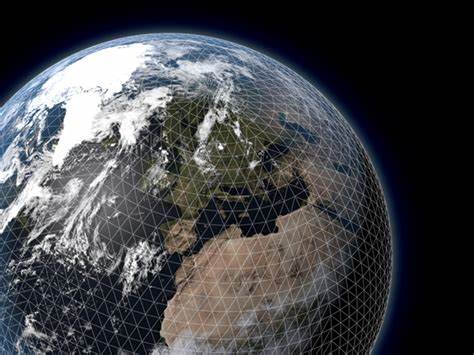
DIGITAL TWINS

The development of a digital twin of the Earth system is at the core of the ambitious EU initiative Destination Earth (DestinE), implemented by ECMWF, ESA and EUMETSAT, under the leadership of the Directorate General Communications Networks, Content and Technology (DG-CNECT).
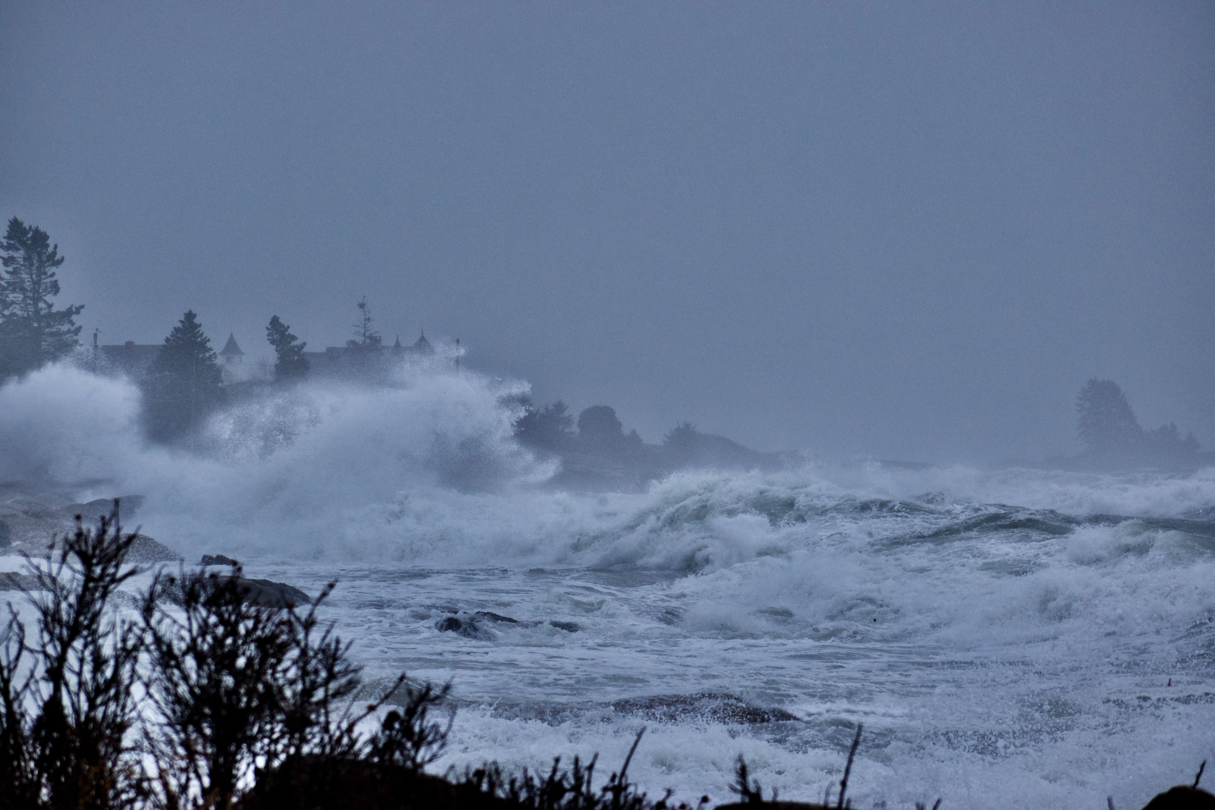
DestinE aims to set up a new type of information system, encompassing unprecedented levels of detail, quality and interactivity, to support society and policymakers to better respond and adapt to the environmental challenges posed by extreme events and climate change.
But what exactly is a digital twin and what are the specifics of this notion when it relates to creating a digital replica of the Earth system?
CONCEPT
"Predictive maintenance"
The idea behind a digital twin
Digital twins are virtual (or digital) representations of products, people, processes and even spatial environments.
Initially used in industrial sectors, a digital twin uses a fusion of numerical simulations and observations to create a virtual replica which is undistinguishable from reality. This allows to understand how the product will perform in the physical world and to explore how it can be adapted to improve its performance.

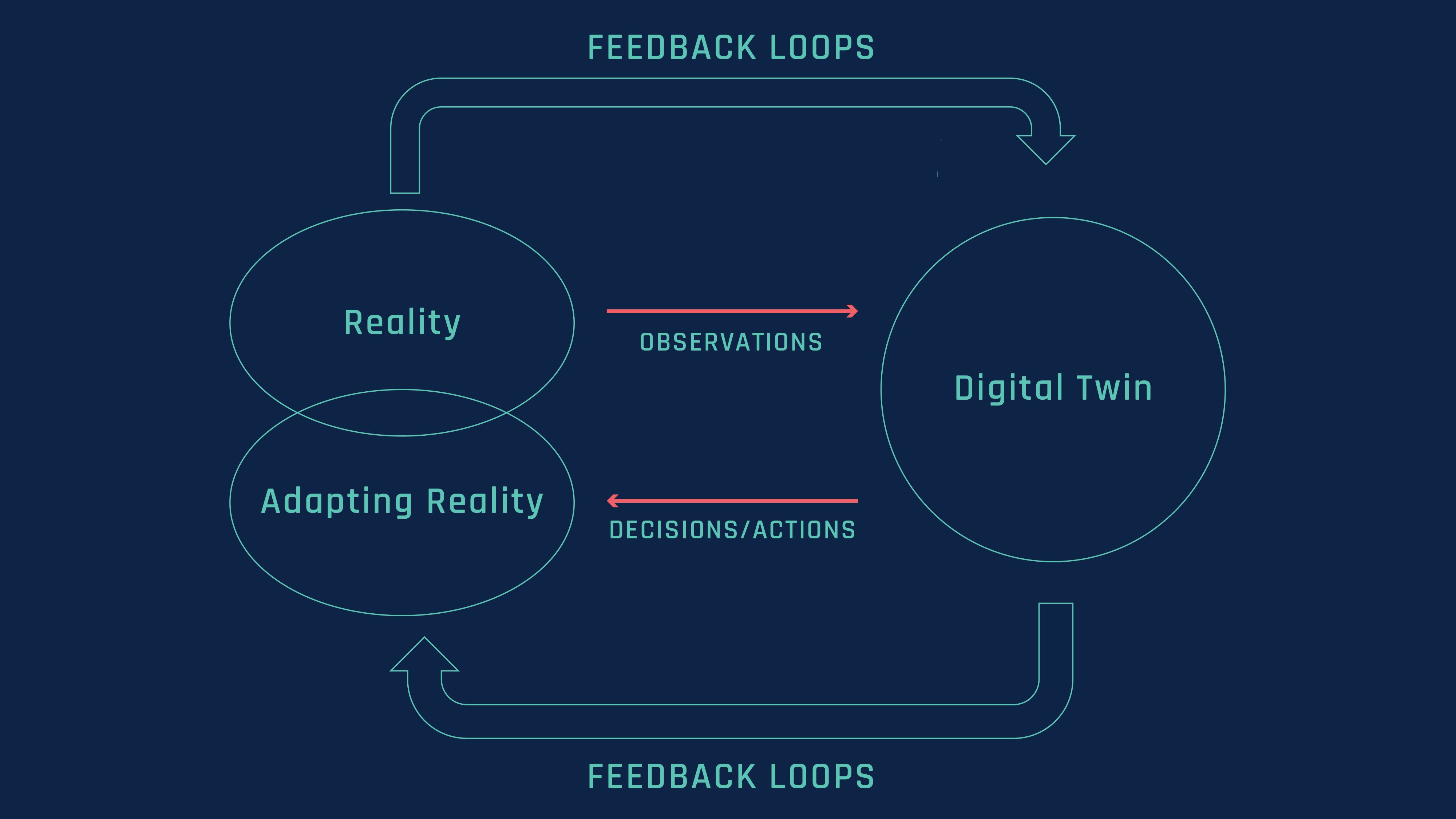
This process allows for what is called the “predictive maintenance”. This refers to the ability to find solutions to potential problems with a product, enabling an endless amount of feedback loops, to take decisions and actions related to the real product.
A digital twin of the Earth system
A digital replica of the Earth system can represent a gamechanger in the context of climate change and the related increase of extreme weather events.
By using a fusion of cutting edge Earth-system physical and data-driven models and observations, it produces simulations which become indistinguishable from the reality, allowing to understand and simulate the complex interactions of the different phenomena which determine how our planet will evolve.
It also allows testing scenarios to assess the impact of human activities and to support actions in response to the environmental challenges the world is facing.
It can thus support decision-making and address the need for enhanced, and more interactive, prediction capabilities.
This is what motivated the development of a digital twin of the Earth system in the Destination Earth initiative.

DestinE thus significantly boosts European capabilities in support of the European Commission’s Green Deal, Data strategy and Digital Strategy, complementing existing efforts in this direction from national and European environmental services like the national meteorological services and the Copernicus services.
DestinE Digital TwinsS

Several digital twins will be developed over the course of different phases of Destination Earth, with two high-priority digital twins currently being developed in the first phase. While the technology behind these two twins relies on the same foundations, the way they operate is slightly different.
ECMWF is responsible for implementing these digital twins, and the Digital Twin Engine, the software infrastructure needed to power the digital twins, on Europe's most powerful supercomputers, those of the European joint undertaking (EuroHPC). For this purpose, ECMWF is closely working with over 60 partners from over 20 countries.
First two high-priority Digital Twins
On weather-induced extremes
The objective of the Weather-Induced Extremes Digital Twin is to support the close to real-time response to meteorological, hydrological and air quality extremes, on a timescale of a few days ahead. This will be key in supporting response actions to environmental challenges posed by extreme events. The global continuous component of the weather induced extremes Digital Twin is implemented by ECMWF, and the on-demand regional component is implemented by a partnership led by Météo France.

On climate adaptation
The objective of the Climate Change Adaptation Digital Twin is to support the efforts of defining and planning activities linked to climate change adaptation on multi-decadal timescales. This will be key in supporting the elaboration of policies for the Green Deal.
The climate digital twin is implemented by a partnership led by CSC.
FEATURES
"DestinE’s Digital Twins build on decades of progress in numerical weather prediction, climate modelling, observations and supercomputing. They exploit the latest breakthroughs in weather and climate science, digital technologies and machine learning, are enabled by the world-leading supercomputing facilities of EuroHPC."
Irina Sandu, ECMWF Director of Destination Earth

Irina Sandu
Irina Sandu
DIGITAL TWIN FEATURES
I. QUALITY
Quality of the provided information.
II. INTEGRATION
Provision of integrated earth-system and impact sector information.
III. INTERACTIVITY
Interactive and configurable access to all data, models and workflows.

QUALITY
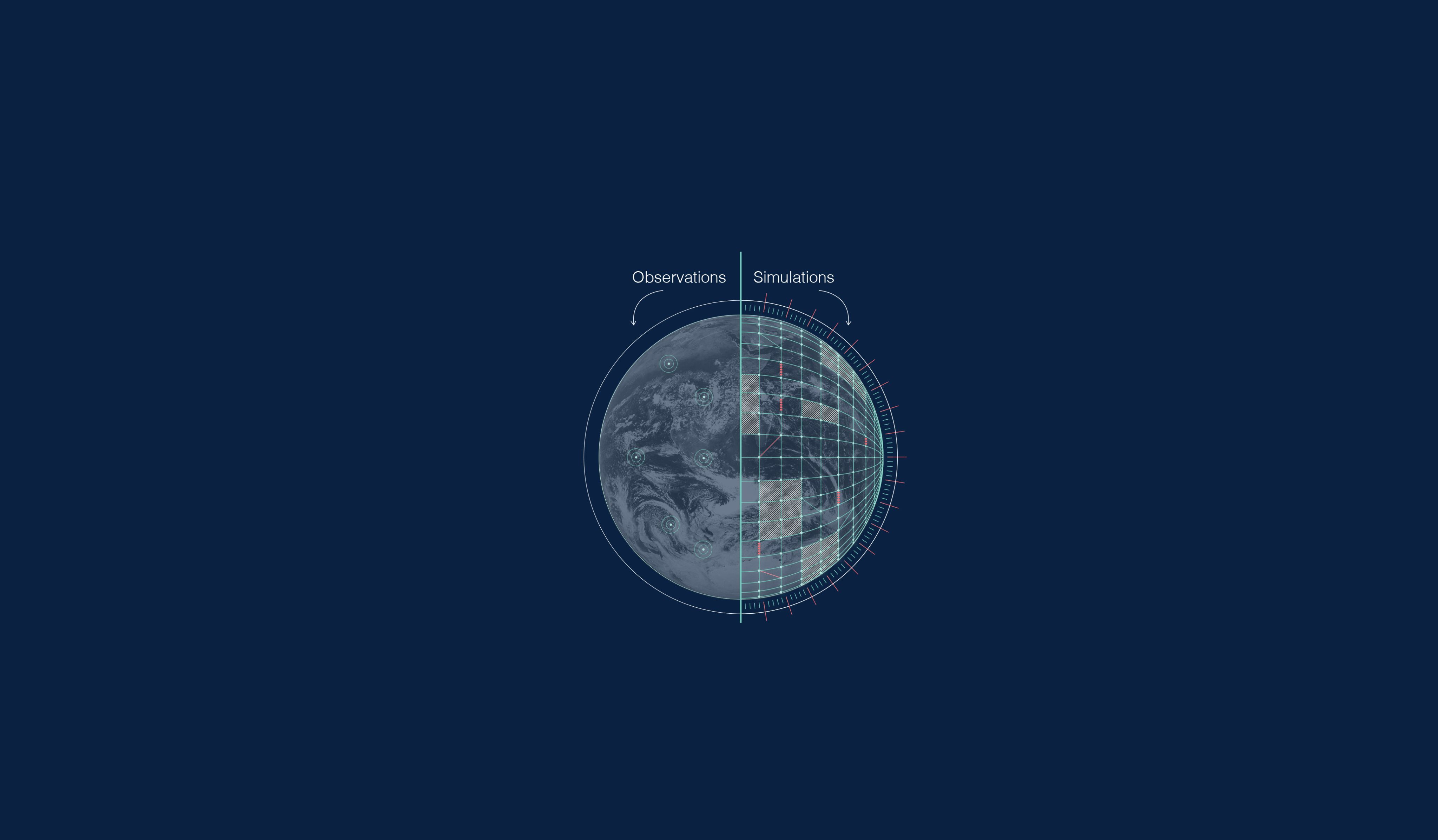
The digital twins will provide high-quality information from global to local scale, based on better simulations performed with more realistic Earth-system models and a better observation-simulation fusion.
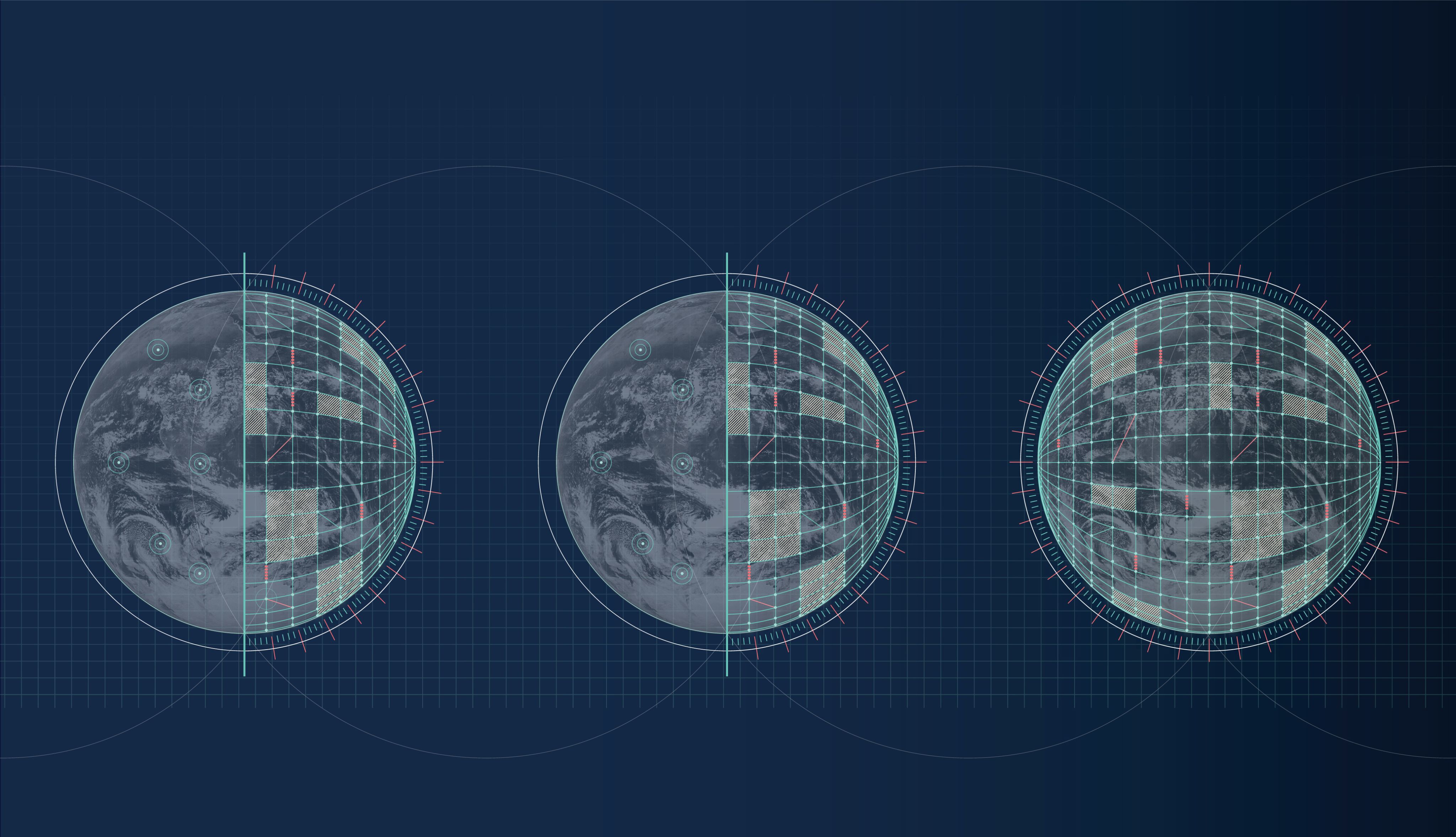
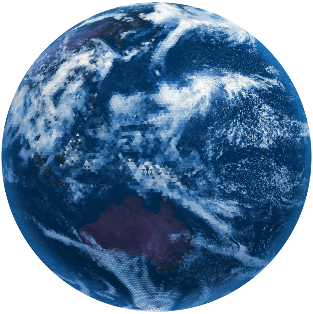
To make a weather forecast and simulate future climate scenarios, scientists use numerical models that carve up Earth' surface into a large number of grid cells, vertically and horizontally, constituting very small zones.
The size of these cells is what is generally called the resolution of the model.
The higher the resolution, the more cells there are.
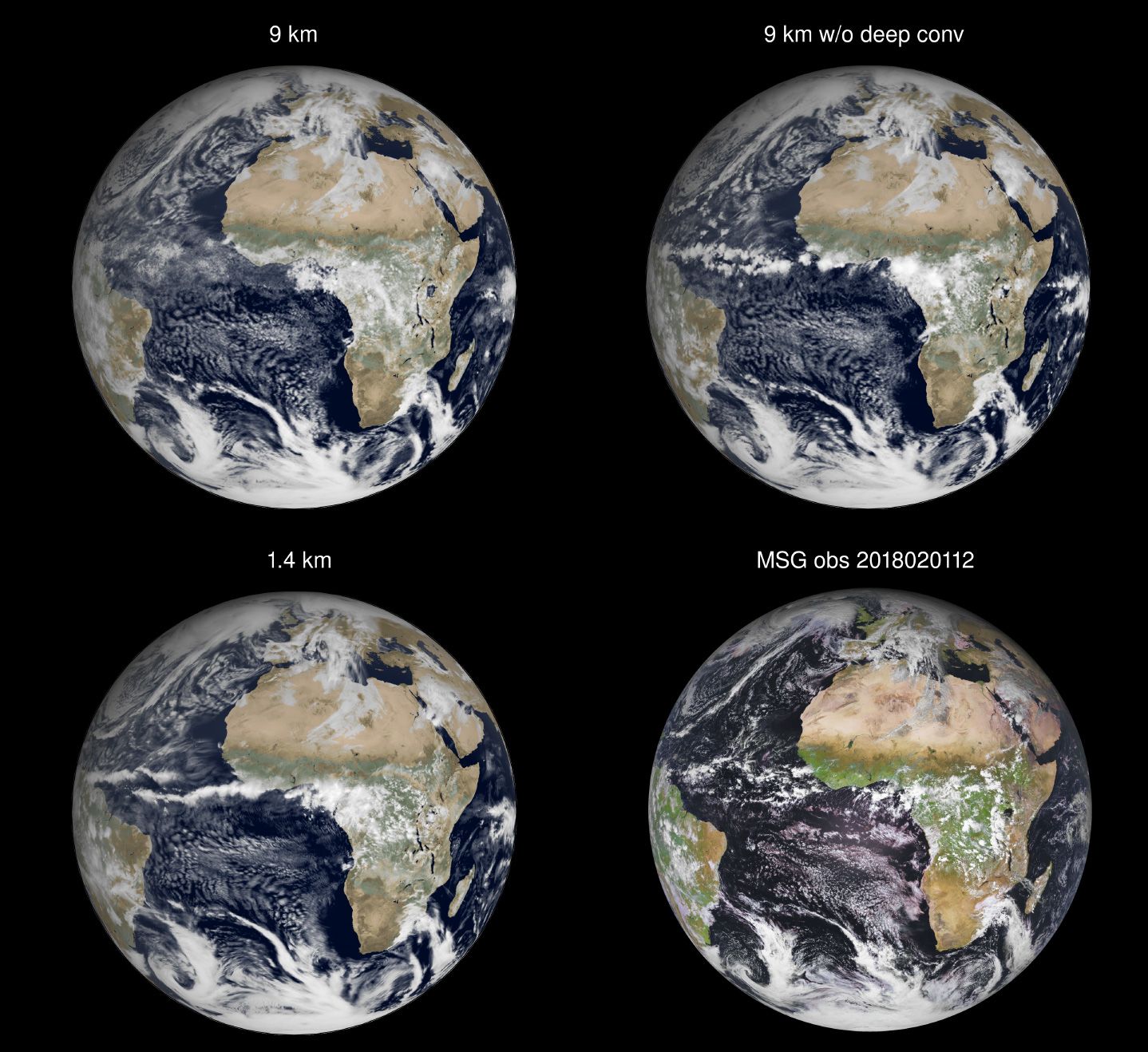
The models for global weather forecasts running at operational centers use a resolution of 9 km at best for the atmosphere and land surface, while global climate models generally use a resolution of about 100 km, and occasionally a resolution of at best 25 km. The highest resolution used for the ocean and sea-ice for both weather and climate simulations is of 25 km.
Weather forecasts have a time horizon of about 15 days while climate models are used for projections of Earth’s climate evolution decades to centuries ahead.
At the resolutions used today for global weather and climate predictions, a number of important small-scale processes which are important for both extreme events, and the evolution of the climate system, are not directly represented by solving the equations of the atmospheric or oceanic flow.
Small-scale processes that are not explicitly simulated need to be therefore parameterised, meaning that their effects on the atmospheric or oceanic flow are accounted for through simplified assumptions.


Convective clouds are a good example of these small-scale processes that need to be parameterised.
Convective clouds are a good example of these small-scale processes that need to be parameterised.
Towards the "km scale"
The new generation of Earth system models.


Increasing the model resolution beyond that used today for global weather forecasts and climate projections towards the km-scale allows to represent such processes more directly. Prototype simulations at such resolutions, performed by the Japanese NICAM group since several years, and more recently in Europe at ECMWF which performed the first seasonal integrations at 1.4km on the ONRL Summit supercomputer in the US, and at the Max Planck institute for Meteorology, demonstrate the potential to improve simulation realism.
An important component for ensuring simulation quality and demonstrating trustworthiness is model evaluation and uncertainty quantification. As part of the development of the digital twins, a framework is being developed to continuously monitor and evaluate the simulations and quantify uncertainties by using observations and machine learning.
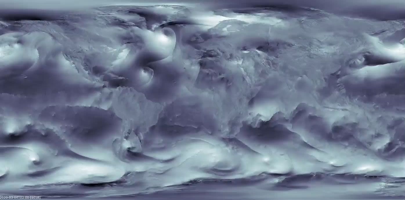
The development of the first DestinE Digital Twins is based on prototypes of so-called "storm-and-eddy-resolving models", such as those developed in the context of European Horizon 2020 project nextGEMS. This new generation of models has much finer resolutions ranging from about 2 to 5 km, in the atmosphere, over land and over oceans and sea-ice. This allows to explicitly represent, at least in part, essential climate processes such as: storms, precipitating deep convection, the effects of the mountains, cities or lakes on the atmosphere, the effects of ocean eddies on the ocean heat transport, and cracks in the sea ice.
Sea ice leads (cracks in the sea ice cover) were shown to have an imprint on atmospheric parameters in IFS-FESOM2 (at 2.8km atm. resolution and about 4km in the ocean/sea ice in high latitudes). Simulation from nextGEMS - video credits Thomas Rackow.
Sea ice leads (cracks in the sea ice cover) were shown to have an imprint on atmospheric parameters in IFS-FESOM2 (at 2.8km atm. resolution and about 4km in the ocean/sea ice in high latitudes). Simulation from nextGEMS - video credits Thomas Rackow.
The on-demand regional component of the Weather induced extreme DT even considers much higher sub-km scale resolutions, of the order of 500 to 700 m over the European domain.
It is only thanks to the advances in supercomputing and the emergence of Europe’s first generation of pre-exascale computers that we can consider to perform simulations at such resolutions for weather and multi-decadal climate timescales in the first two digital twins.

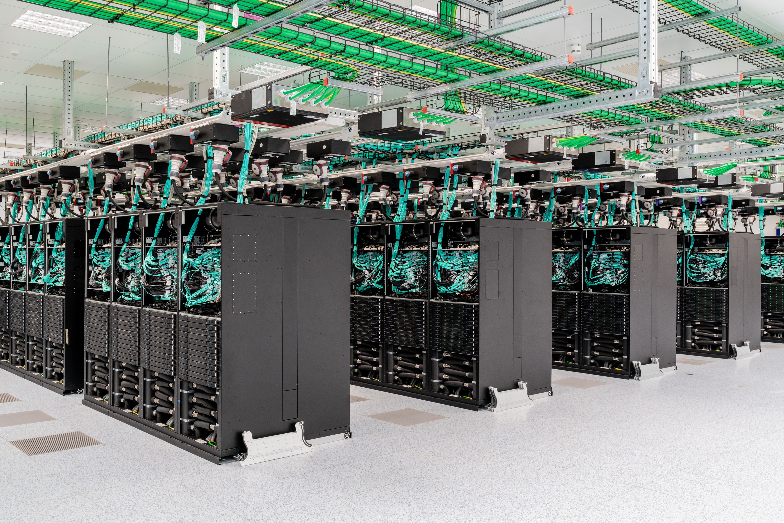
A decade of investments in scalability, for example in the ECMWF Scalability programme, is also playing an important role in enabling this new leap.

The first global coupled simulations at these storm-and-eddy-resolving resolutions performed in nextGEMS offer glimpses into the potential breakthroughs in simulation realism that these models can bring.
The global dance of clouds and winds in the global storm resolving model ICON- nextGEMS Cycle 1 coupled run at 5 km resolution. Credits Felicia Brisc, CEN/UHH.
Temperature over Europe for 2.5 months as simulated by ECMWF model IFS with 4km spatial resolution - nextGEMS cycle 2. Credits Nikolay Koldunov, AWI.
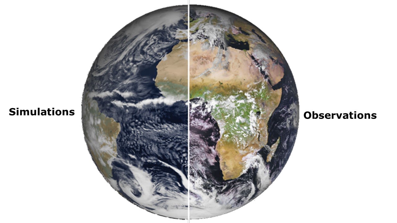
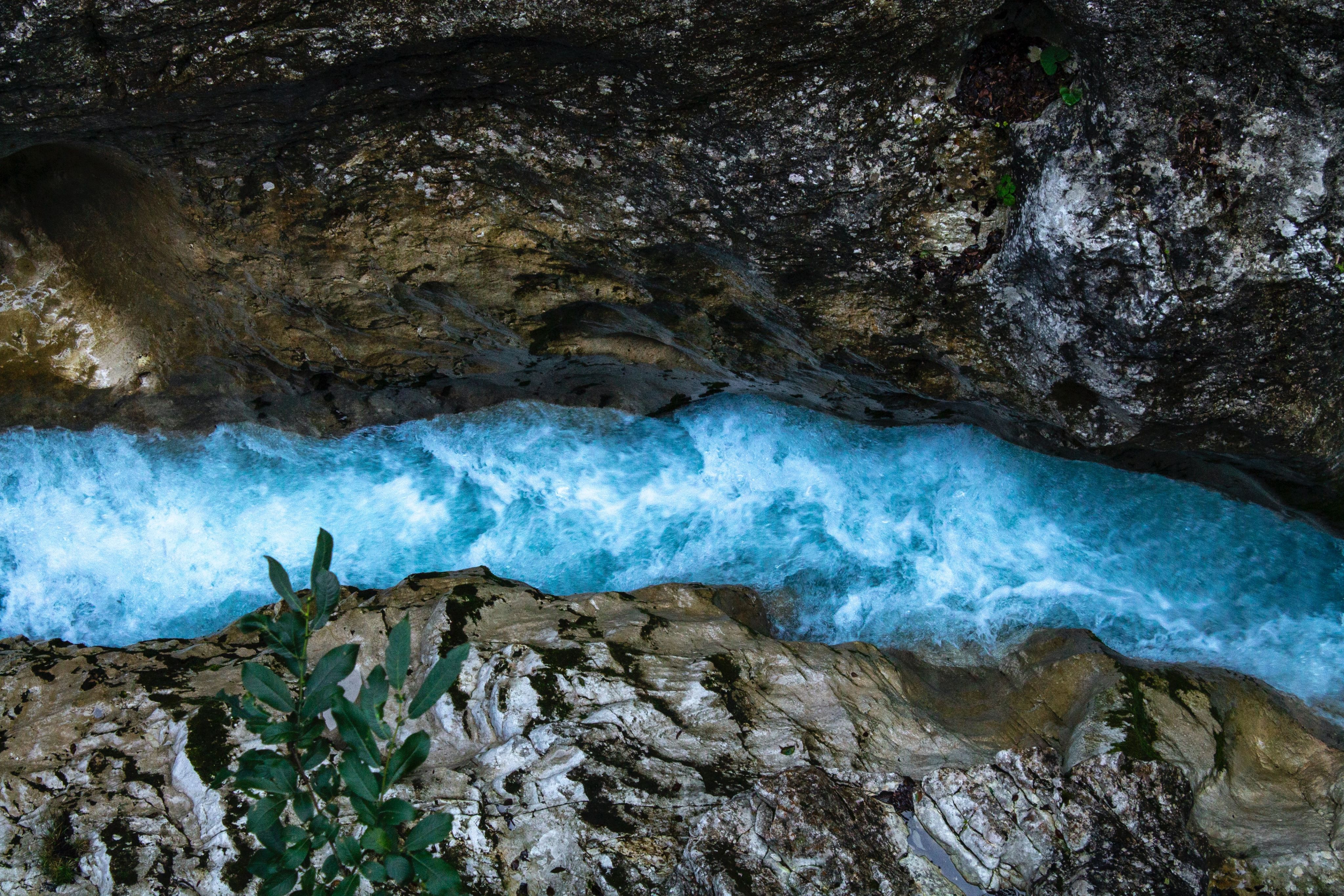
The first simulations at 2.8 km performed for the global continuous component of the weather-induced extremes digital twin, also demonstrate that the simulations are remarkably similar to observations.
Left: the first image by the new MeteoSat Third Generation Imager (MTG-I1). Right: simulated satellite image, forecast at 2.8km from IFS and forward operator RTTOV. Credits Philippe Lopez and Benoit Vannière.
Left: the first image by the new MeteoSat Third Generation Imager (MTG-I1). Right: simulated satellite image, forecast at 2.8km from IFS and forward operator RTTOV. Credits Philippe Lopez and Benoit Vannière.
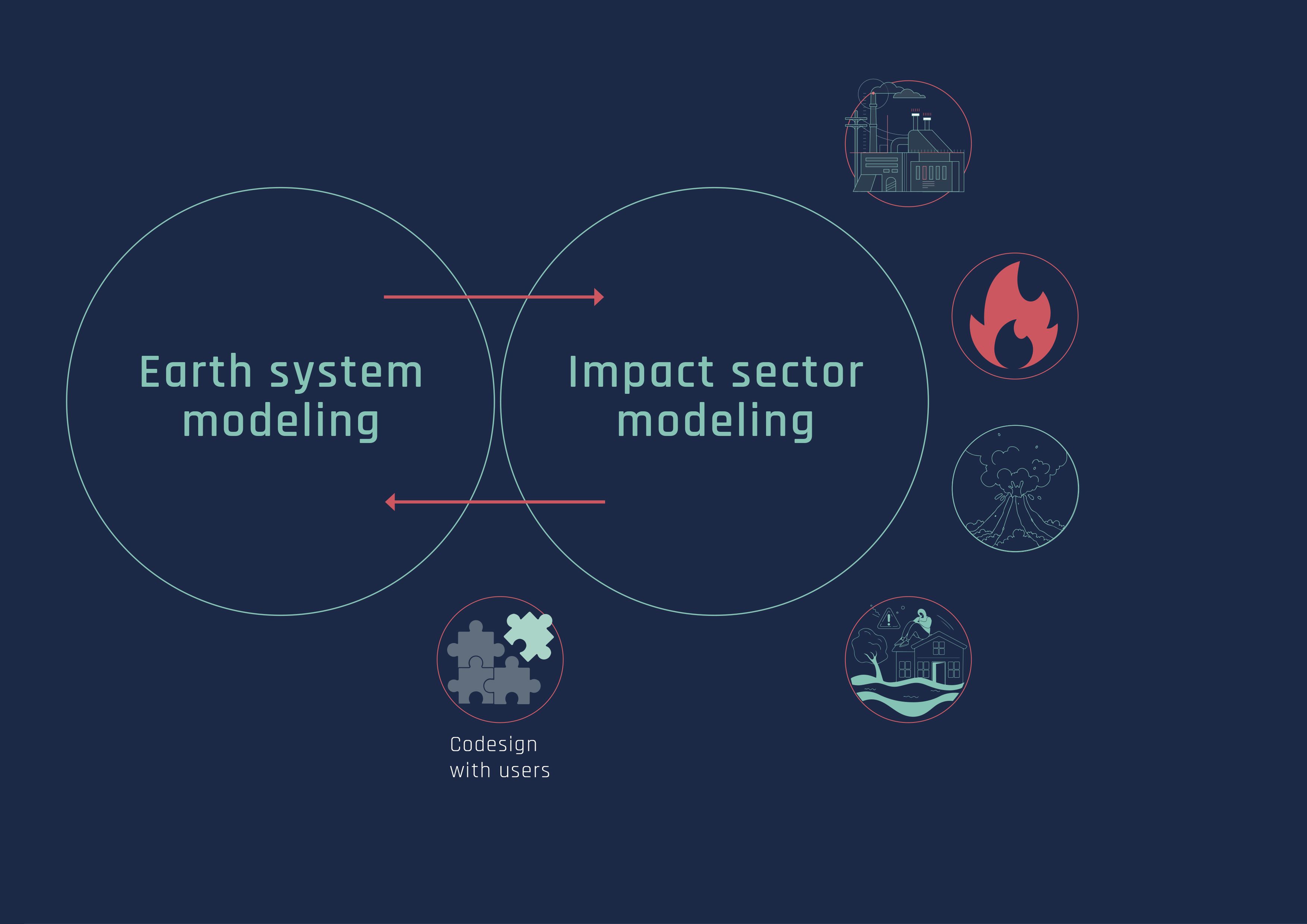
INTEGRATION
Towards an integrated Earth system and impact sectors modelling framework.
Reliable information for impact sectors
By using unprecedented resolutions globally, the storm and eddy resolving models underpinning DestinE’s Digital Twins will enable the provision of accurate information on the local scale, where the impacts of climate change and extreme events are felt.
It is essential to provide accurate information at these local scales not only for meteorological variables, but also for impact sectors such as agriculture, forestry, energy, air quality and water resources.

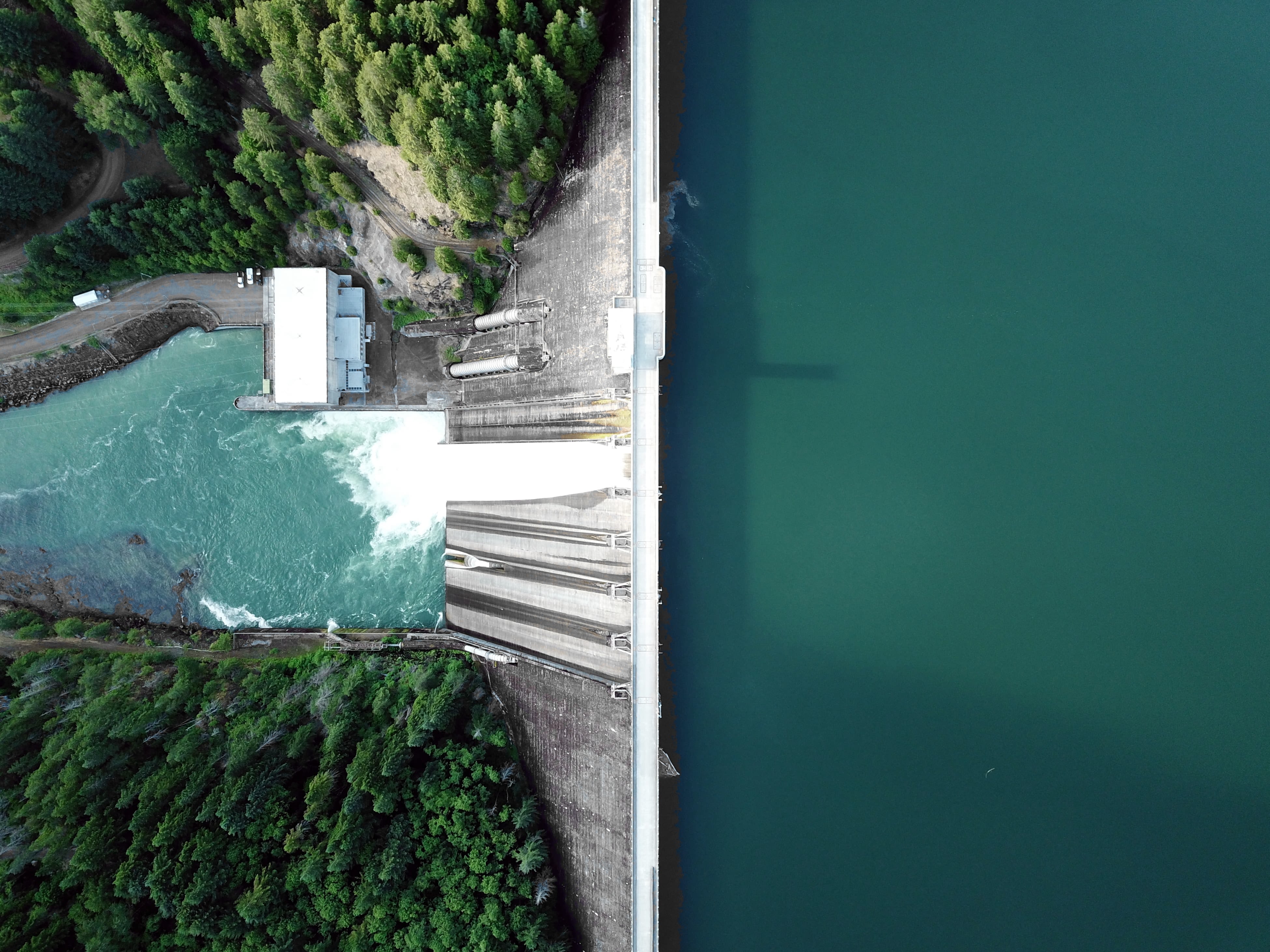

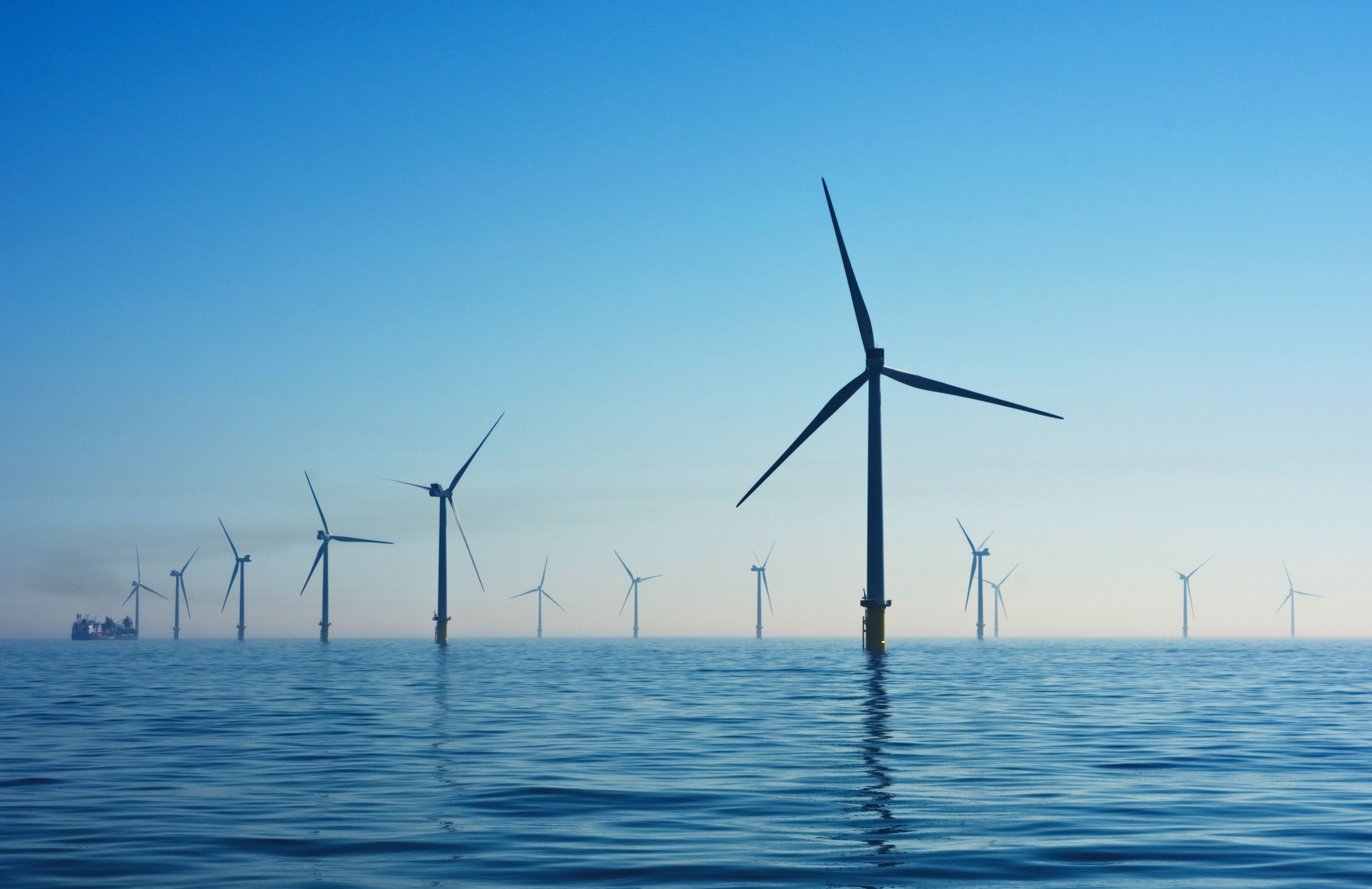


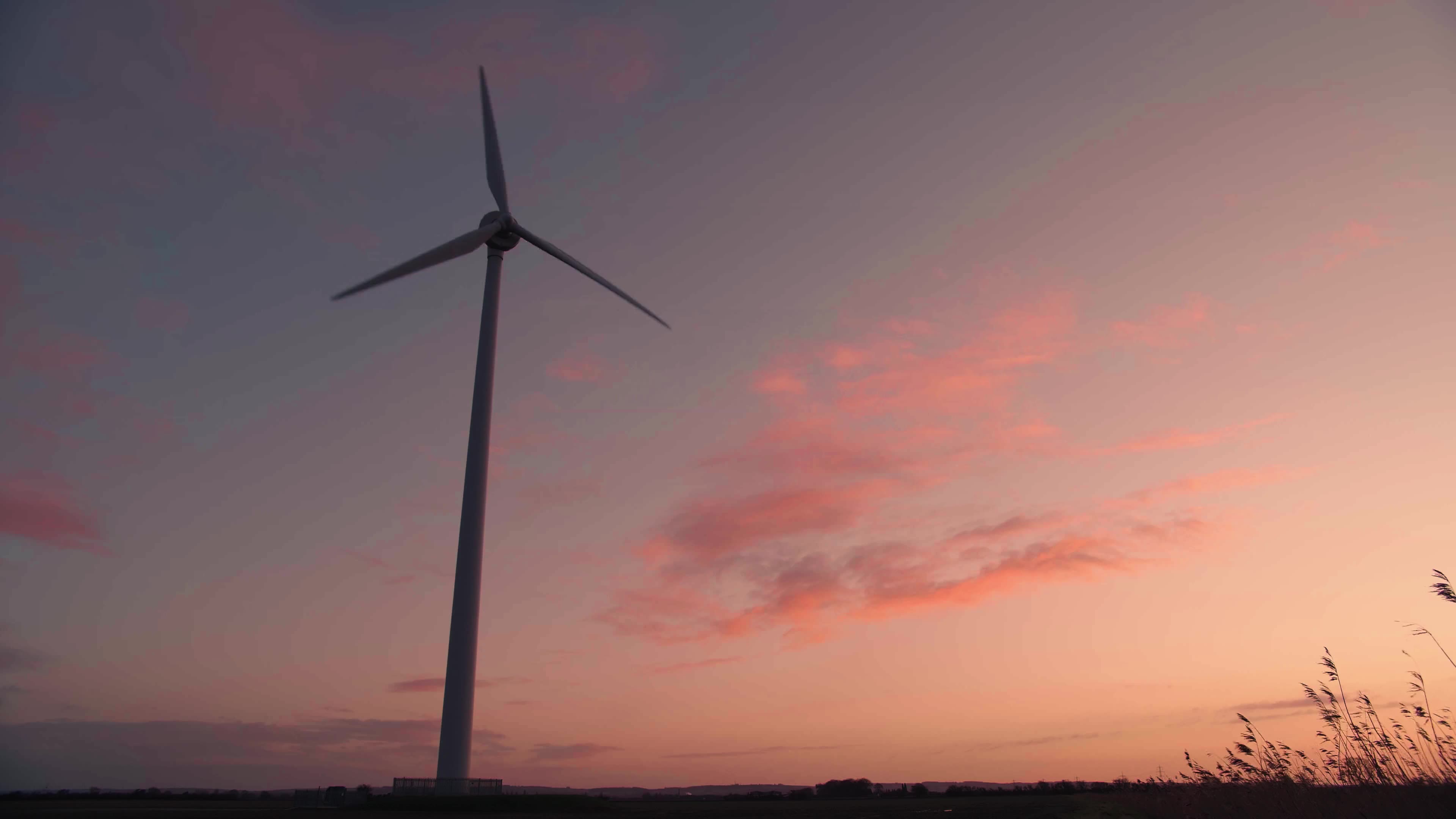
Understanding how wind energy will fluctuate at a certain location in the context of an approaching storm, or looking into the levels of the discharge of a certain river for the next 30 years, is extremely valuable for the planning of renewable energies or water resource management.
New ways of working
With the digital twins and multiple decades of global km-scale simulations come gigantic volumes of data. The digital twins are expected to produce 1 petabyte of data per day.
Currently, information generated by weather and climate models is stored physically on disks and then downloaded by users for different purposes. But this approach is not suitable for the entire volume of data produced by the digital twins.
Towards data-streaming
This is why a new method, similar to the process of data streaming, is foreseen to be put in place with the development of the digital twin technology. This system will allow users to read and capture the information they need while the digital twins are running. This is made possible by bringing the models and users’ applications within the same workflow.
In the streaming concept, the output of a digital twin is handled on-the-fly as it is being produced.
The users interact with the dataflow, by deciding what is produced, incorporating their algorithms and applications to intersect the data, and becoming an active part of the production pipeline.
"As the data volumes involved will be unprecedented, DestinE will create a shift in paradigm where we move away from bringing the data to the users to bringing the users to the data. ” Irina Sandu
This paradigm shift is achieved in a close collaboration between ECMWF, EUMETSAT and ESA, who are the three entities implementing the DestinE initiative. EUMETSAT is in charge of the data lake, containing the digital twin data and other sources of data, and ESA develops the core platform through which users can access and interact with the digital twins and their data.


Colocating Earth system and impact-sectors models
In the context of novel information systems, bringing the impact models into the digital twins workflow, and coupling them with the Earth-system models is a significant innovation of the DestinE novel information system.
From "cascade" models...
Current information systems have pre-defined cycles and set-ups where models mostly run following a so-called “cascade process” based on an established path of information.
For example, meteorological information from a weather model is used to feed a hydrological model which is used to produce hydrological forecasts of river discharge and inundation areas, once the weather forecast has been performed.
To integrated systems.
In a first step, the Digital Twin will bring together the components of an entire Earth system, namely both the physical processes and the modelling of aspects relevant for important impact sectors like air pollution, flooding or wildfires in the same modelling chain. This means that the impact sectors applications will be able to run side-by side with the Earth-system simulations, access the data stream and extract the information they need while the digital twin is running.
This will allow the applications to access all data rather than a previously agreed subset of model outputs.
In a second step, the idea is to fully couple all elements of the Earth-system including selected impact-sector relevant modelling elements which can influence its evolution, like hydrology or air pollution. This would ensure for example that changes in rivers and inundated areas feedback on the atmosphere, allowing a more realistic representation of the whole Earth-system.

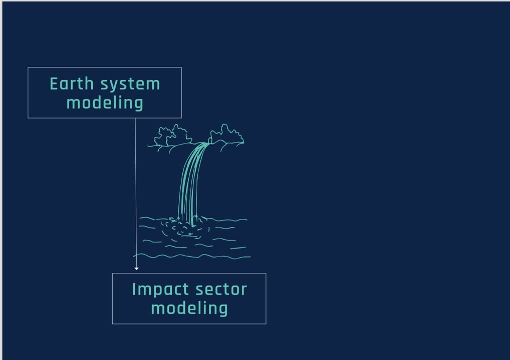

By integrating the digital twin workflow, a hydrological model would have full access to simulated precipitation and will be able to compute river flows as the weather model runs.

In the longer term, the idea is to fully couple these elements, so that the changes in rivers and inundated areas can feedback on the atmosphere and influence the evolution of the coupled system.
Through co-design

Various users from the impact sectors are involved in the digital twins' development from the start of the process. This "co-design" approach is central to Destination Earth and aims to ensure that the digital twins are tailored to users' needs.
With dedicated "Use Cases" in the frame of Destination Earth, ECMWF ensures that the digital twins are built taking into account the gaps in information' s needs of the different users for different application areas.
INTERACTIVITY


With this integrated framework comes the prospect of building an interactive information system allowing for configurable access to data, models and workflow to users. Ultimately, the interactive features of the Digital Twin will allow for users to access tailored information and explore "what-if" scenarios.
These interactive features will gradually become available and will be expanded over the next phases of DestinE. The recent advances in the application of machine learning for weather and climate offer opportunities for enhancing the interactivity of DestinE’s Digital Twins, for example by using a combination of physical and machine learning models.
A solution with unparalleled insights to anticipate and adapt
DestinE’s digital twins will provide unparalleled insights into the complexity of our planet and support society and policy makers to respond, anticipate and adapt to the major environmental challenges the world is facing, complementing thus existing capabilities at national and European level.